
You must truly be a Welsh maps enthusiast if you have come to read part-2, after the part-1 series. We’ve gathered some more of Welsh maps shown on our Facebook page. How many of these can you recognise?
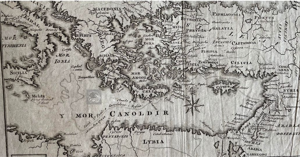
#1. Comes from the Welsh Bible.

This map is titled ‘Teithiau’r Apostolion’ (‘Travels of the Apostles’) and comes from the Welsh Bible published by Peter Williams in 1770 (diolch, Robert).
It is fascinating to see this part of the world in Cymraeg!
#2. The earthwork that roughly lines the border between present day Cymru and England.
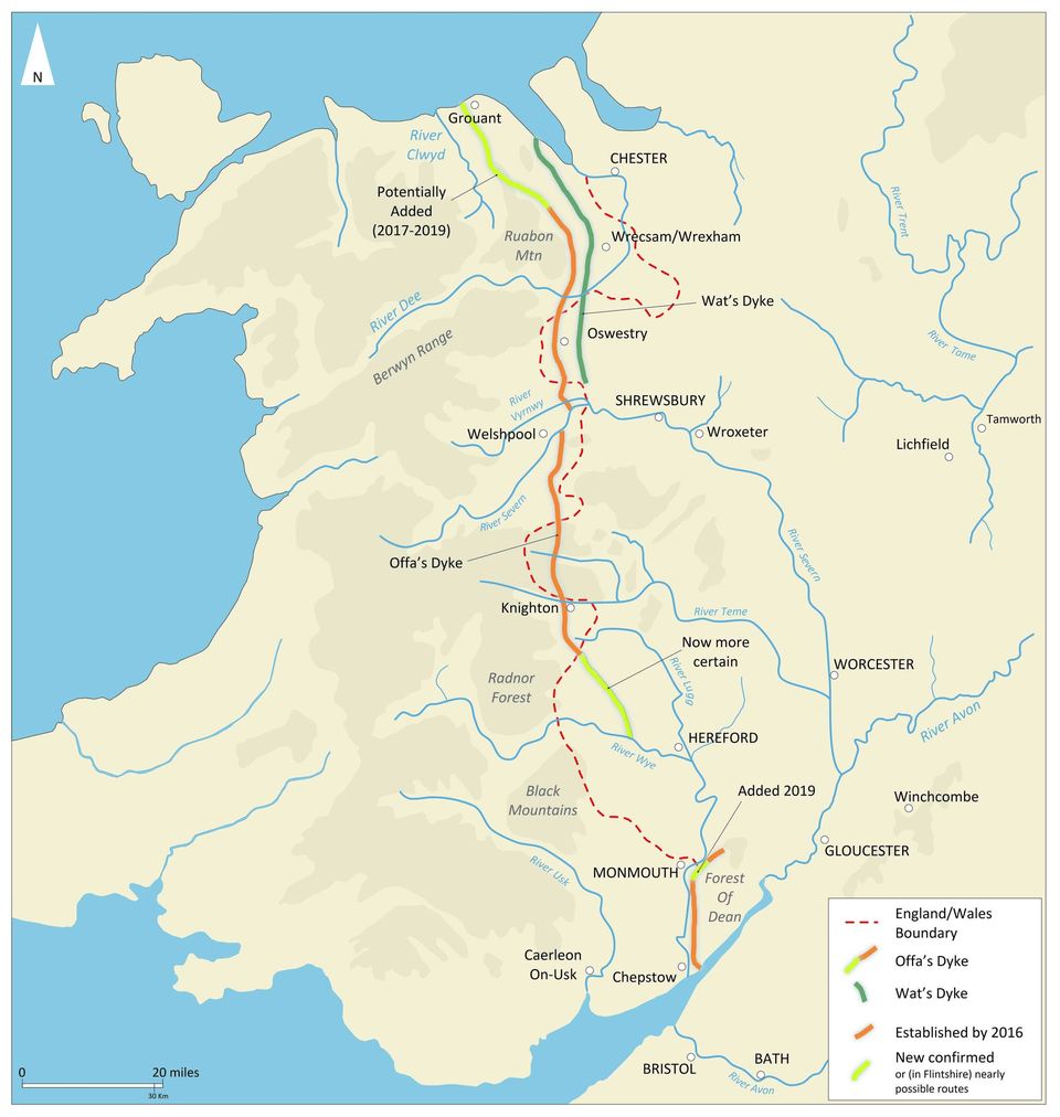
The Offa’s Dyke Path opened on this day (July 10) in 1971!
Offa’s Dyke is the earthwork that (quite poorly in the present age, because Wrecsam is on the English side) roughly lines the border between present-day Cymru and England.
King Offa of the Kingdom of Mercia was the one to order the construction of the Offa’s Dyke. It was both a display of power and command of the people, and it also didn’t prevent future Mercian and Welsh struggles.
Many people today walk the entire length of Offa’s Dyke, which goes sea to sea (285 km in length) and connects Prestatyn (North Wales) with Cas-gwent (Chepstow). If you follow the path entirely, you will also cross the Welsh and English border 20 times!
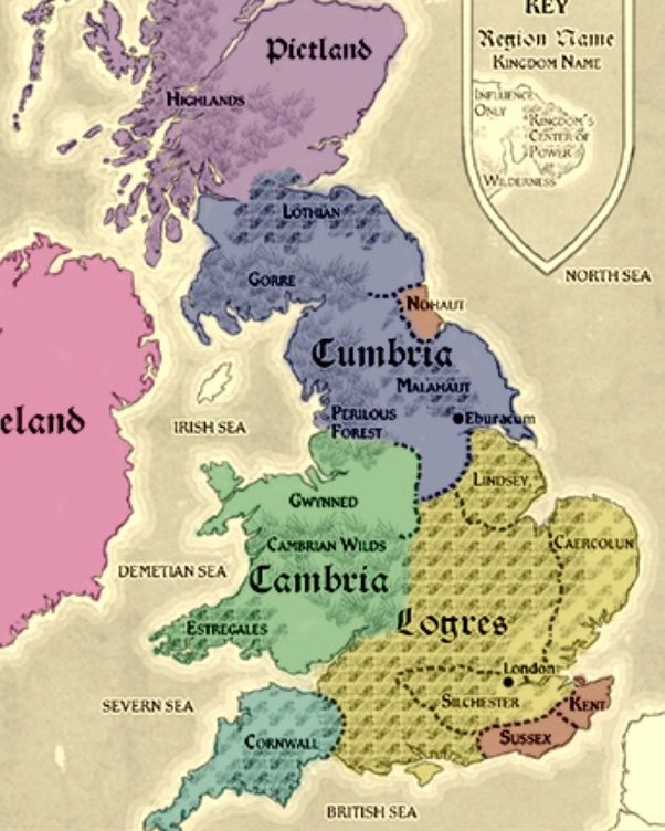
#3. Cymru map according to Mabinogion.
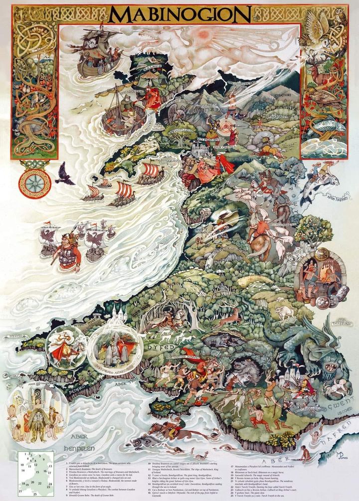
Here’s a fun one! A map of Cymru according to the Mabinogion. Let me know what’s going on in your Mabinogi location!
#4. Covering Castles Across Cymru.
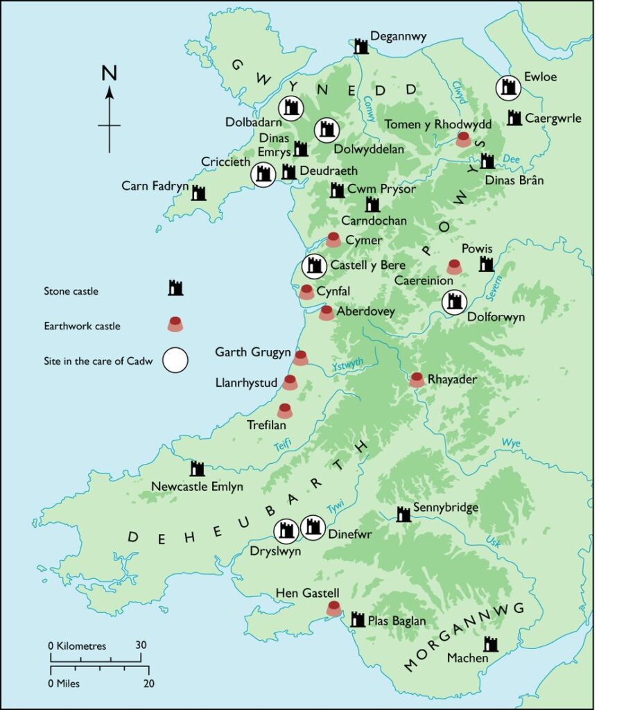
Here is a map covering some of the important castles in Cymru. Have you got a favourite?
Note: These are native castles, so don’t expect to find Conwy, Caernarfon, Beaumaris etc. If it’s not shown on the map, it is probably non-native!
#5. Common surnames in Cymru and England.
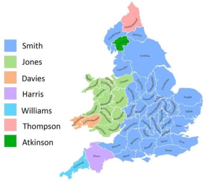
Here is a map which shows the most common surname in each of the counties of Cymru and England (sorry, Scotland, I didn’t make the map).
I do know many a Jones, to be fair. It is also my mother’s maiden name!
Related:
- Whatever the Situation, Welsh Can be Experts in Humour. Here’s Proof.
- 10+ Pics that Prove the Welsh Have the Best Humour.
- Weird Things People Found on Welsh Google Maps That May Surprise You.
- People are Sharing Moments that Prove Welsh People are Really Nice and Friendly
- 10+ Funny Welsh Duolingo Moments That Made Me Laugh So Hard, I Peed a Little
- Welsh Photos that Will Take You Back to the Good Old Days
#6. Origins of “Cymru.”
We all know about the etymological origins of “Wales” and how it means “foreigner”. We are also familiar with the origins of “Cymru” and how it means, roughly, “people of the land”. However, what about the origins of the Welsh word for England, “Lloegr”?
It has been believed for centuries that “Lloegr” is an old Brythonic (the parent language of Welsh) word which translates as “lost land”. It is understood that this originally referred to the lands of the Kingdom of Mercia – an Anglo Saxon kingdom which occupied much of the west midlands, which had previously been lands of the Britons before the Saxon invasion in the 7th century (as is evident in present day Shropshire, where there remains numerous Welsh-named towns and even, in some small pockets, Welsh speakers).
There is no concrete etymological sources to prove this, however, though it is certainly a romantic origin for “Lloegr” and makes one ponder whether or not it is true.
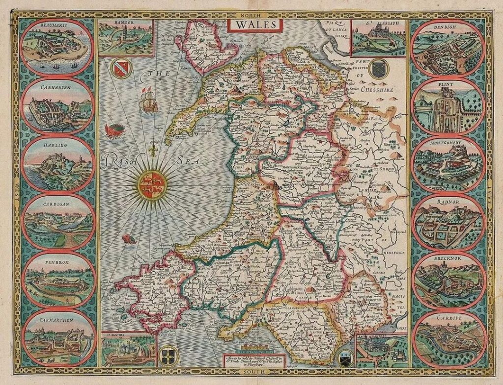
#7. An old map of Cymru, 1579.
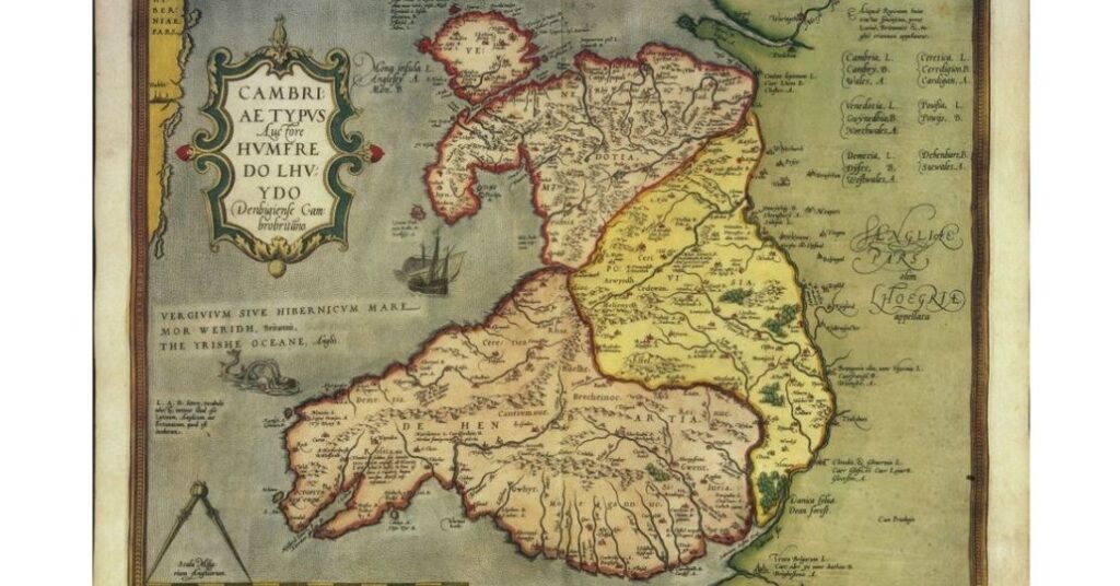
This is an old map of Cymru published posthumously in the year 1579. It was a product of the Welsh cartographer, Humphrey Llwyd (1527-1568).
Can you notice any differences between this map and current ones? 🧐
#8. An Englishman’s map of Cymru.
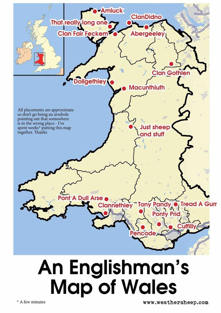
I can’t speak much for De Cymru but in the north I do hear “ClanDidno”, “Clan Fair Feckem” and “That really long one” a lot from the English… and from some Welsh, actually. 😒
#9. A map of Wales created off of the Laws in Wales Acts.
This map is titled “Wales” and was created by John Speed all the way back in 1610 AD.
This was relatively fresh off of the Act of Union/Laws in Wales Acts (1535 and 1542) and the thirteen counties visible on the map were the result of Henry VIII’s laws.
You might also notice some difference between the pictures of the towns then and now!
#10. Connection between Cymru and Breizh (Brittany).
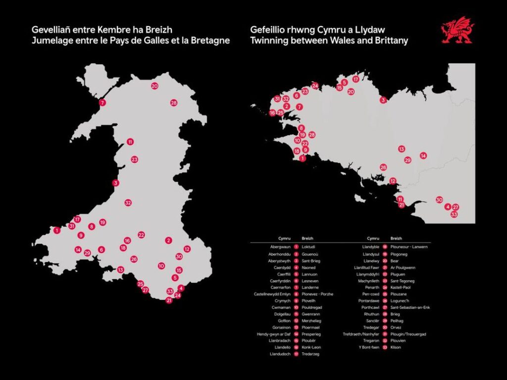
Here is a map showing all locations twinned between Cymru (Wales) and Breizh (Brittany). It is well-established that both have many connections.
Our history has entwined many times; our native languages (Cymraeg and Brezhoneg) share origins (with our friends in Kernow) in the Brythonic language and we are two of the six “Celtic Nations”.
Furthermore, we share a national anthem!
#11. Mythical Beasts of Wales
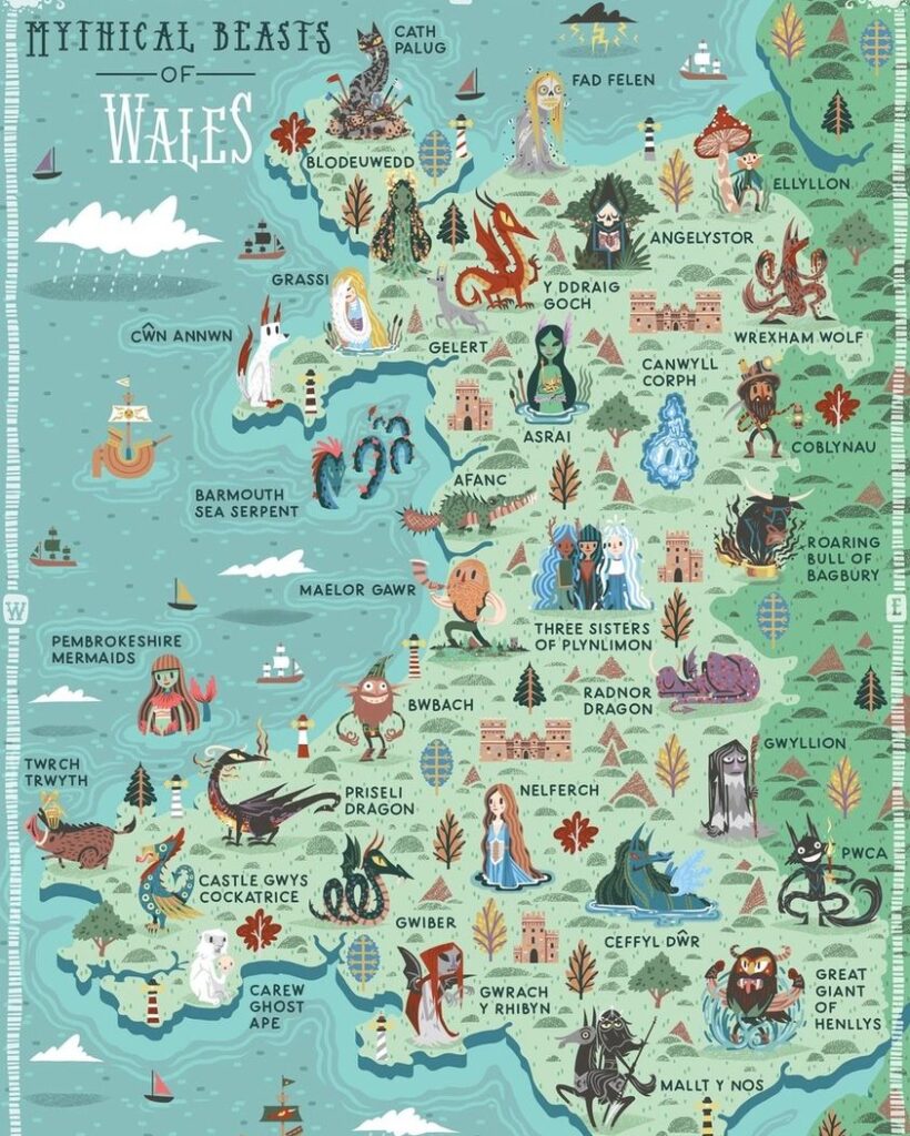
As many will know, we do have our own Welsh mythology which dates back thousands of years. This map, however, does contain some more modern fictional characters, such as the dog Gelert in Beddgelert, Gwynedd.
It is still an excellent map, though!
Share us your favourite Welsh maps on niklas@welshhistories.co.uk
-
DIGITAL COPY Welsh Histories Magazine – April 2024
£0.99 -
DIGITAL COPY Welsh Histories Magazine – April 2025
Original price was: £2.99.£1.99Current price is: £1.99. -
DIGITAL COPY Welsh Histories Magazine – August 2024
£1.99 -
DIGITAL COPY Welsh Histories Magazine – August 2025
Original price was: £3.99.£1.99Current price is: £1.99.

More from Welsh Histories
Welsh Histories is a Welsh history celebrating platform which looks to promote all aspects of Welsh history. Though we focus predominantly on native Welsh history, we do also share the non-native aspects from time to time. You can follow us on Facebook; Instagram or Twitter for more. A reader? We also have our very own Welsh Histories Shop where we sell our Welsh Histories Magazine. Diolch yn fawr iawn and keep enjoying Welsh Histories
2 thoughts on “Welsh Maps That Will Make You Feel Smart About Welsh History (Part 2)”
Comments are closed.