Your basket is currently empty!
Welsh Maps Which Shed Light on Our History
We’ve gathered a list of Welsh maps shown on our Facebook page. How many of these can you recognise?
#1. Map that estimates the approximate location of individual tribes around the year 50 BC.
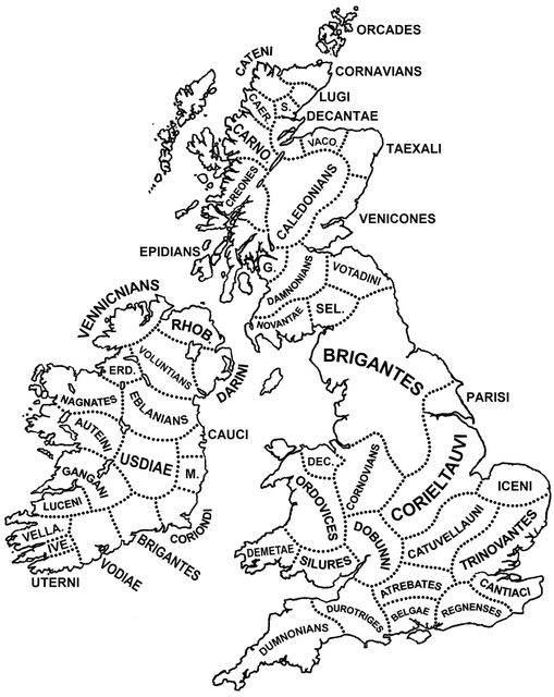
Many of the tribes took their names from pan-Celtic deities, which is why some of the names may repeat (such as the Brigantes in Ireland and the Brigantes in northern England).
Remember, there is no way of determining this with 100% accuracy. If records were kept by ancient Britons around this time, they were almost certainly lost to/rewritten by the conquering Romans.
#2. Map of Cymru during the 13th Century
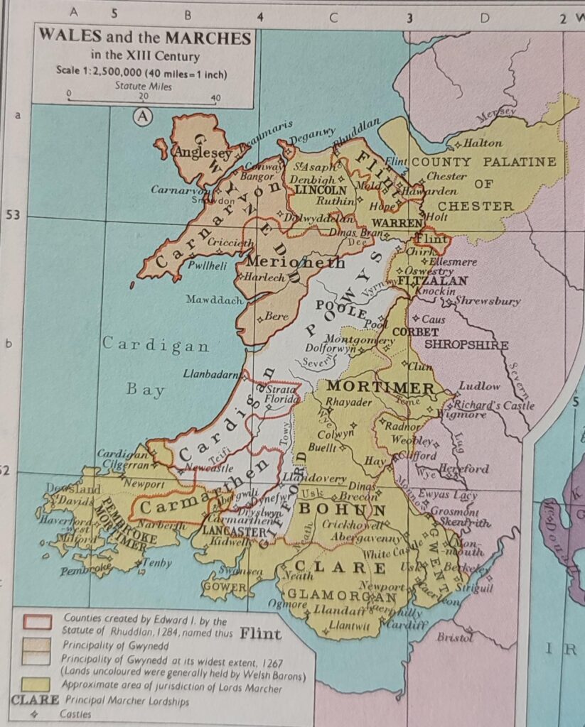
This was a time of much conflict between the Cymry and the Norman-English, hence many of the more Norman names visible on the map.
Throughout the 13th century, the various Welsh kingdoms would gradually be absorbed into the Kingdom of England. Though some high points took place in the early part of the century with rulers like Llywelyn Fawr, by 1283, the Conquest of Wales was complete.
The key at the bottom explains what the different colours mean.
#3. Cymru and its counties with their names in Chinese characters.
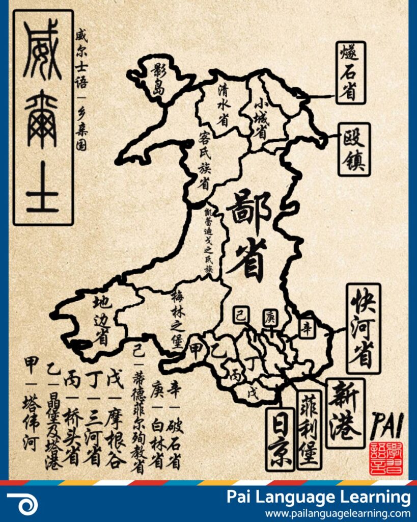
Abertawe (Swansea) would translate to 塔伟河, which would be “Tawei River”. Pretty cool!
Reading this, Griffiths commented, “I was learning mandarin years ago and my teacher was telling everyone how to say England, when I asked why Wales had a different suffix to other countries she said it was because Wales isn’t an actual country.”
#4. Map which simplifies (and oversimplifies) Welsh dialects.
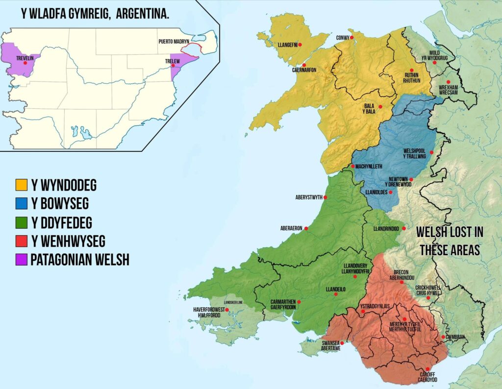
It is still useful, however. Those learning Cymraeg will be familiar with the concept of different dialects present within the language.
For example, a native speaker in the north will have some linguistic differences with a native speaker of the south. Think Sutmae/swmae, ti’n iawn, etc.
Also, “Welsh Lost in These Areas” is something I disagree with – I have definitely heard Welsh spoken in these areas!
Jordan-Thompson added, “People speak Welsh in and around Wrexham, it might be around 11%, but that means we deserve to considered Welsh-speaking. Particularly Rhosllanergrugog, where my taid was from, which has always been mainly Welsh-speaking with its own dialect and according to this is in the English-speaking part of Wales.”
#5. This includes an old Celtic calendar that marks the days and months in the languages of the Six Celtic Nations: Breizh, Cymraeg, Irish, Kernowek, Manx and Scottish.
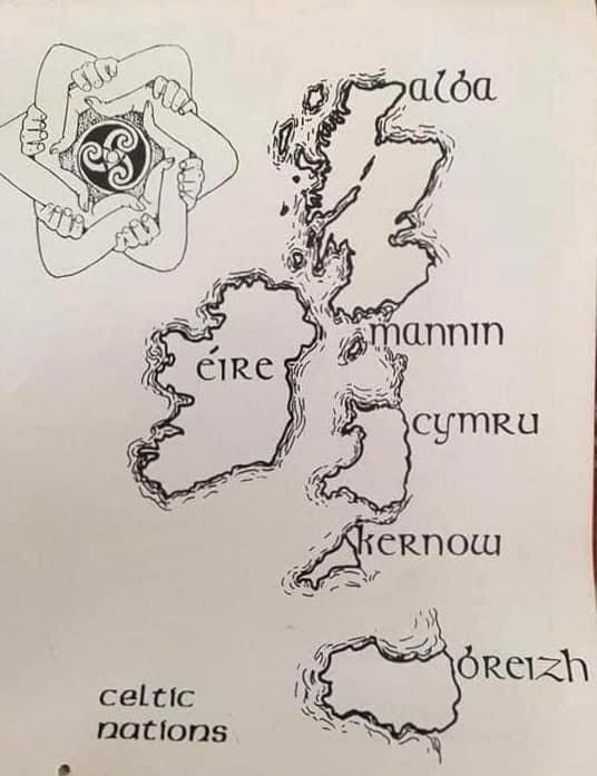
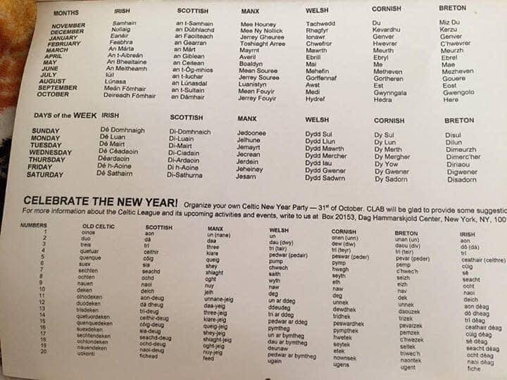
There is also a map included, which shows the native name for each of these Celtic nations. Pretty cool!
#6. This Welsh map depicted in the picture is a 13th century Matthew Paris (1200-1259 AD) map of the island of Great Britain and, I must confess, I have never seen this one before.
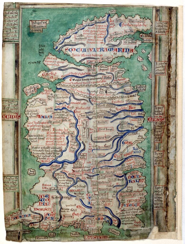
Cymru is referred to in the map as “Wallia”, which was a Medieval Latin term for “Wales”. If you zoom in, you will be able to spot some of the interesting names used for parts of the country and figure out how modern names evolved from there.
For example, Yr Wyddfa is referred to as “Snaudun”, which would evolve into the later Anglo name “Snowdon”.
#7. Did you know that more than half of the Welsh population (estimated at around 2/3 of it) lives below the line?
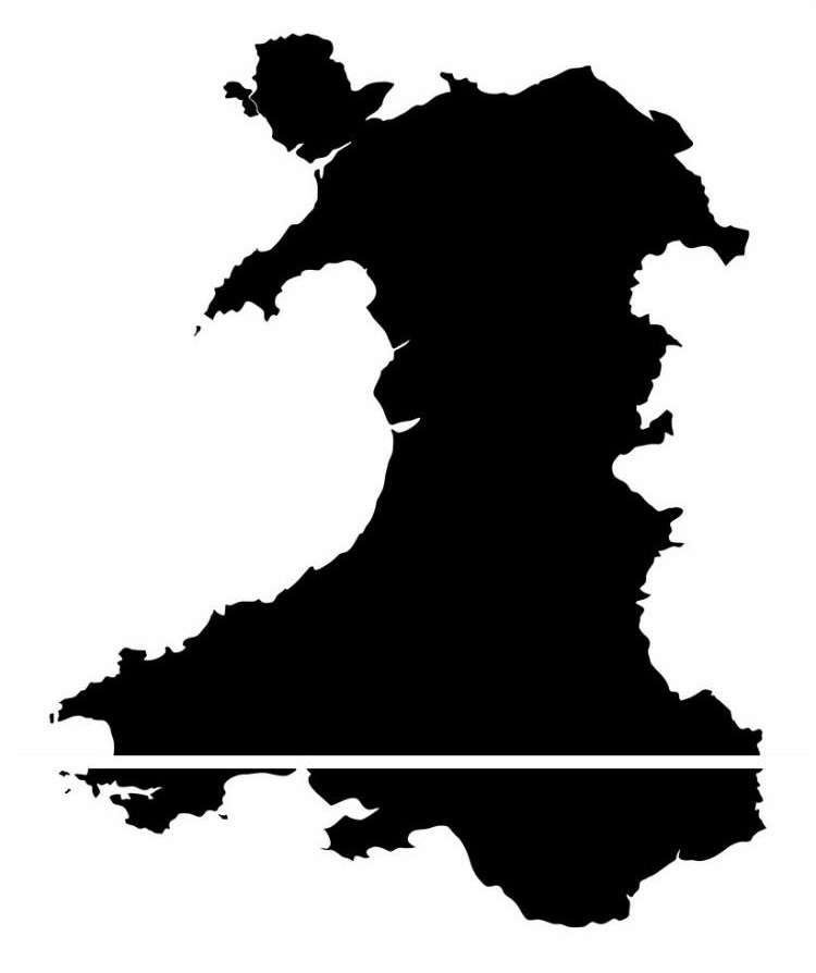
It makes sense, actually. If we attempt to make this Welsh map history related, we could refer to the rapid industrialisastion of de Cymru (south Wales) in the 19th century. Cities like Caerdydd (Cardiff), Abertawe (Swansea) and Casnewydd (Newport) ballooned in terms of population whilst gogledd Cymru (north Wales) remained relatively agricultural, with exceptions.
Examples of the population growth are: Abertawe rising from a modest population of 6,831 at the start of the 19th century to a population of well over 100,000 by its end. Casnewydd went from 6,657 in 1801 to 79,342 in 1901. Caerdyff rapidly grew from 1,870 to around 164,000 in the same period.
In contrast, the largest city in the north, Wrecsam, had a population of 5,000 at the turn of the 19th century but didn’t even reach 30,000 until the middle of the 20th century.
#8. A Welsh map depicting all of the rivers in Cymru.
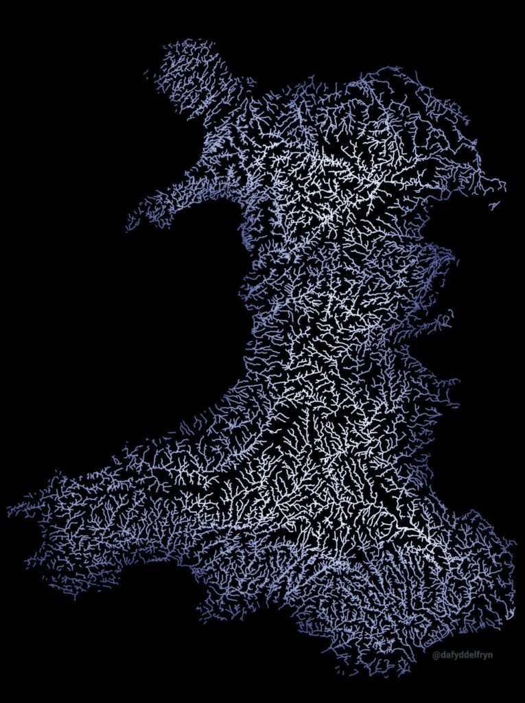
I honestly didn’t know there were quite so many (and I am assuming this map includes small streams) but it is fascinating to see on this Welsh map.
The longest river in Cymru (and all of Britain) is Afon Hafren (the River Severn), which lasts for 354 km from Mynyddoedd Cambria in the middle of Cymru right down to the Bristol Channel.
Afon Hafren is first recorded in the 12th-century “Historia Regum Britanniae” and has origins in the much earlier, Old Welsh name “Afon Habren”, which was recorded in the 8th century.
#9. I just saw this amazing Tolkien themed Welsh map and felt compelled to share it with you!
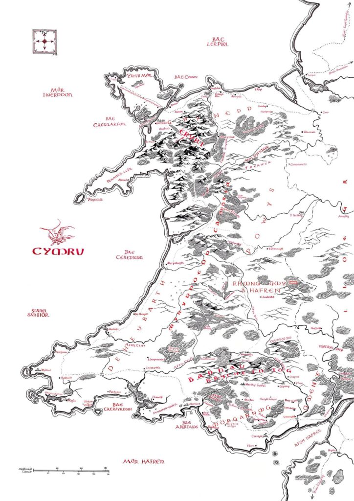
For those who don’t know about this Welsh map…
J.R.R. Tolkien, the genius behind “The Hobbit” and “The Lord of the Rings,” was not only a literary mastermind but a philologist deeply connected to Cymru. His works are steeped in the influence of Welsh language, mythology, and landscapes. In his own words, he referred to Welsh as the “senior language of the men of Britain.”
Tolkien’s appreciation for the Welsh language went beyond mere admiration. He embedded Welsh linguistic elements into his fictional world. The Elvish languages of Quenya and Sindarin, which feature prominently in “The Lord of the Rings,” exhibit clear Welsh influences, both in phonetics and structure. This linguistic artistry lent authenticity to Middle-earth.
The mythological tradition of Cymru was another wellspring of inspiration. The tale of the Mabinogion, a collection of Welsh legends, offered parallels to Tolkien’s storytelling. Elements of the Mabinogion, such as the enchanted Cauldron of Rebirth, are visible in Tolkien’s works.
Share us your thoughts about Welsh maps on [email protected]
PS- If you’re fond of Welsh maps, this colourful map may come in handy.
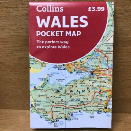
Reviews: ”In a time when we all have Google, you will soon realise that parts of Wales 🏴 has no phone signal so a map is ideal, this one is as good as it gets.”
”This map shows contours, rivers, roads, and paths and all you need for planning routes and day trips…so handy just to pop in your pocket or glove box.”
Staff picks
-
(UK ONLY) YEARLY Subscription Welsh Histories Magazine
£79.99 -
(US & CAN ONLY) YEARLY Subscription Welsh Histories Magazine
£129.99 -
DIGITAL COPY Welsh Histories Magazine – April 2024
Original price was: £2.99.£1.99Current price is: £1.99. -
DIGITAL COPY Welsh Histories Magazine – August 2024
£3.99
More from Welsh Histories
Welsh Histories is a Welsh history celebrating platform which looks to promote all aspects of Welsh history. Though we focus predominantly on native Welsh history, we do also share the non-native aspects from time to time. You can follow us on Facebook; Instagram or Twitter for more. A reader? We also have our very own Welsh Histories Shop where we sell our Welsh Histories Magazine. Diolch yn fawr iawn and keep enjoying Welsh Histories.
*This post may contain affiliate links, which means we may receive a small commission, at no cost to you.*
Sally is a proud wife of a Welshman, editor & writer of Welsh Histories. She’s all about stories—that shout ‘anything Welsh.’ Drop her an email if you have an advice, insight, experience, or a story to share.
