Your basket is currently empty!
Welsh Maps That Will Make You Feel Smart About Welsh History
We’ve gathered a list of Welsh maps shown on our Facebook page. How many of these can you recognise?
#1. Flags of various counties on the island of Great Britain.
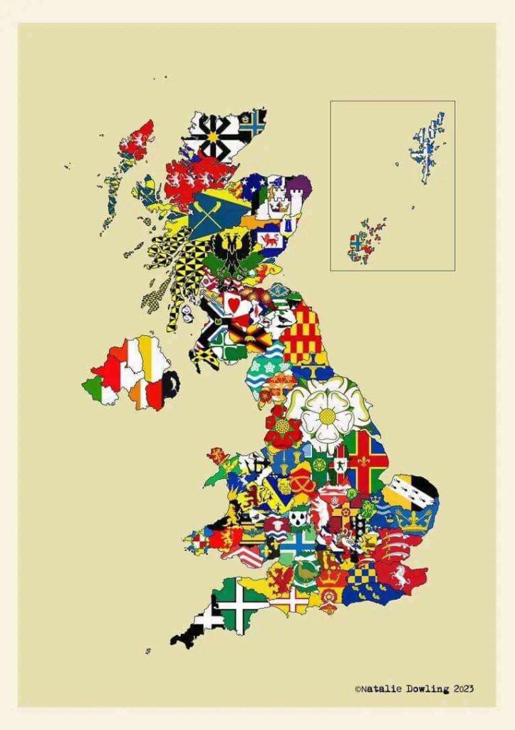
Here’s a map which displays the flags of the various counties on the island of Great Britain (and the counties of Northern Ireland).
Some are modern, some date back to medieval times.
#2. Welsh borders and its concentration of castles in Cymru and England.
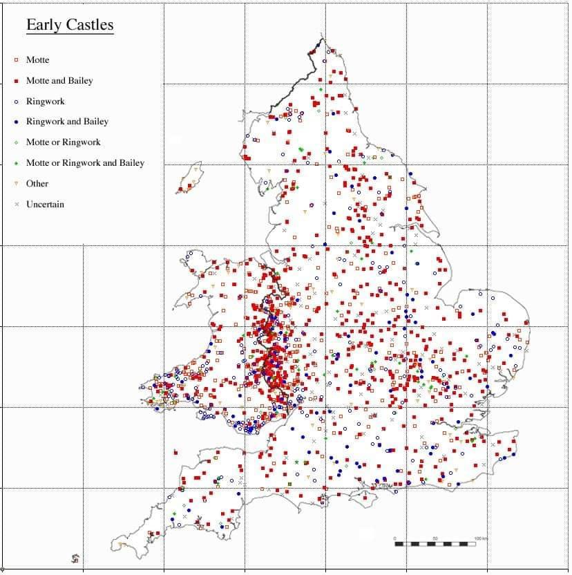
Here’s a map which shows that, during the Middle Ages, the Welsh border had the greatest concentration of castles in all of Europe.
Many castle ruins remain whilst many are lost. What’s certain is that the border was hotly contested between the Welsh and the Saxon (and later Norman) invaders.
#3. A literal map of Wales.
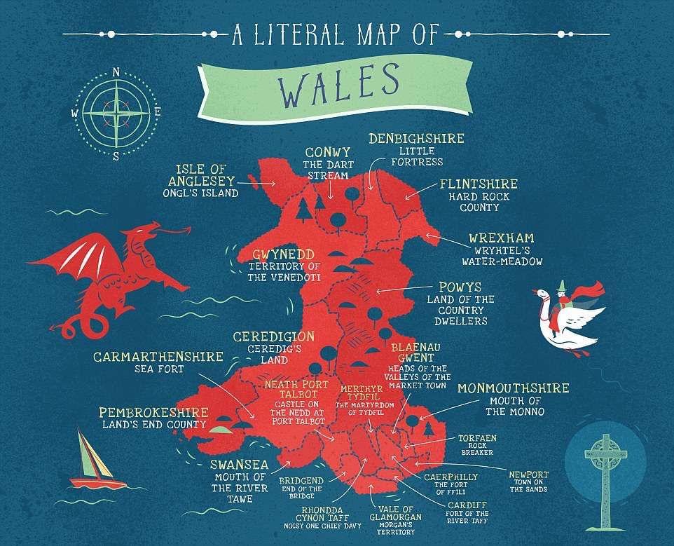
This cool map appears to show how some of the early pioneers in the British Isles left their mark through county place names that are still in place today.
Cymru is perhaps most unique in that its county names have Roman, Celtic and Anglo Saxon language origins.
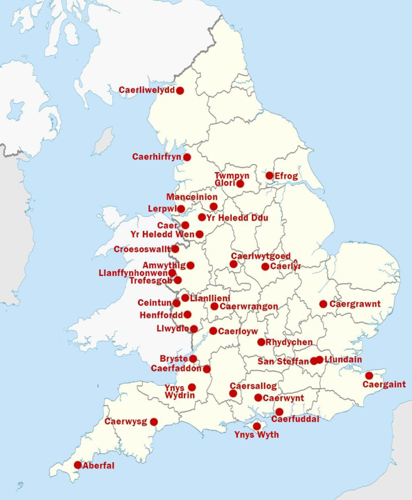
#4. English towns and cities, but with a twist – they’re in Cymraeg.
Related:
- Whatever the Situation, Welsh Can be Experts in Humour. Here’s Proof.
- 10+ Pics that Prove the Welsh Have the Best Humour.
- Weird Things People Found on Welsh Google Maps That May Surprise You.
- People are Sharing Moments that Prove Welsh People are Really Nice and Friendly
- 10+ Funny Welsh Duolingo Moments That Made Me Laugh So Hard, I Peed a Little
- Welsh Photos that Will Take You Back to the Good Old Days
#5. Medieval Welsh kingdoms.

Here is a map which shows some of the medieval Welsh Kingdoms (of course, borders were forever altering during the medieval period).
Which would you have belonged to?
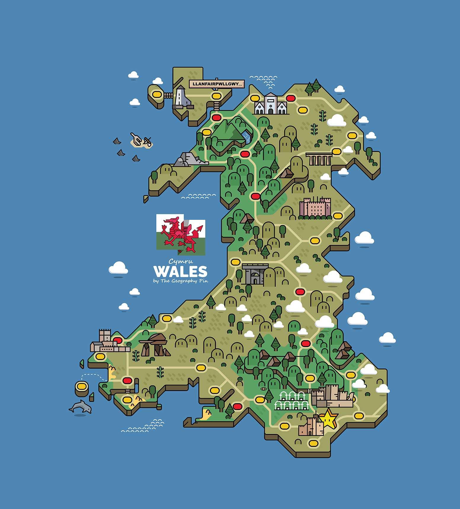
#6. Mario-Styled map of Welsh landmarks.
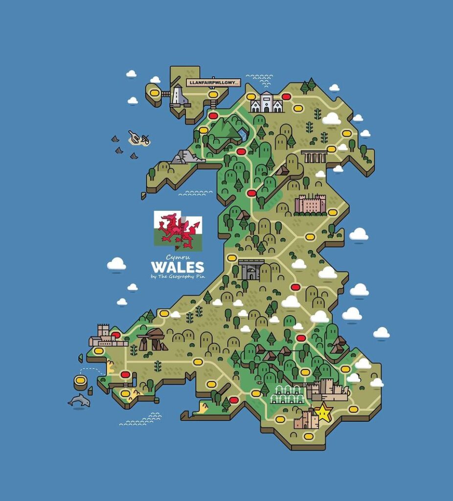
This is an awesome retro Super Mario styled map of Welsh landmarks.
So far I can see Pontcysyllte Aqueduct, Powis Castle, Maen Ceti, St David’s, Eryri and plenty other landmarks. Can you spot them all?
(Credit goes to TheGeographyPin @ Reddit for making the map)
#7. Non-Celtic place names within Cymru.
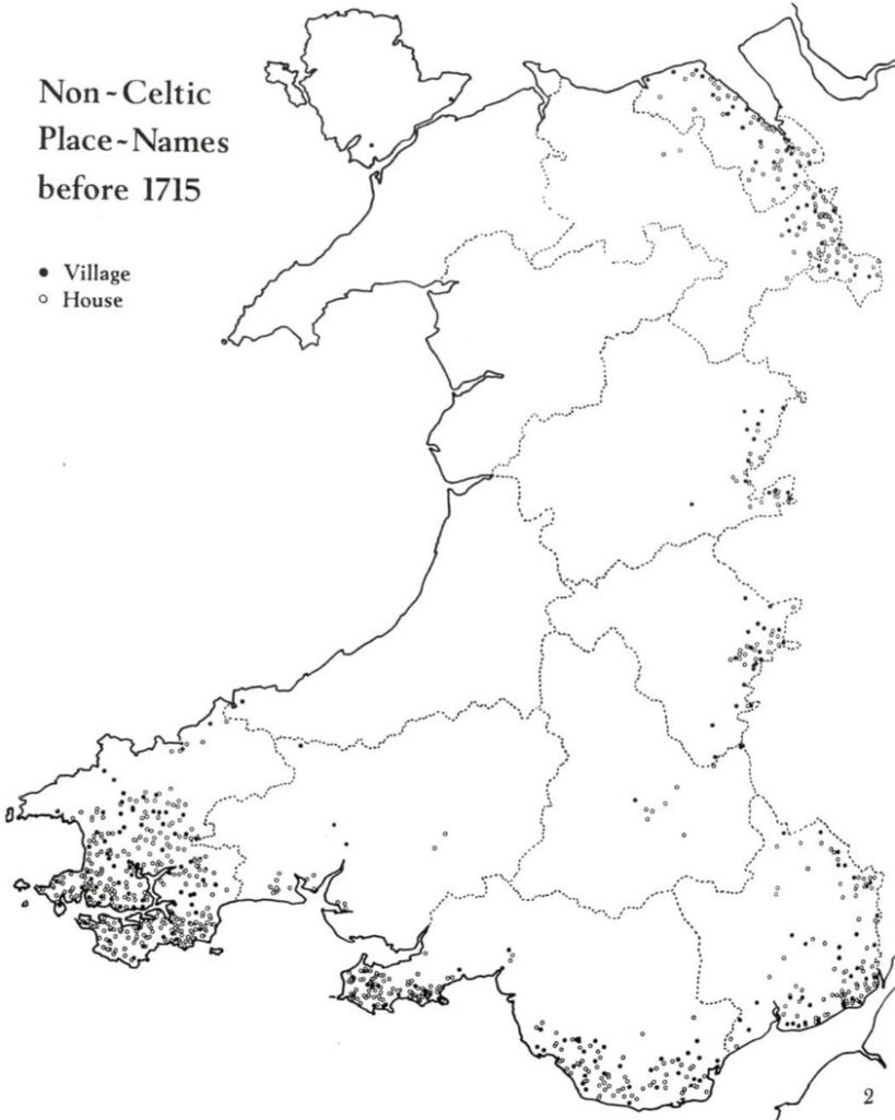
(Credits: Houses of the Welsh Countryside by Peter Smith)
Here’s a map that shows non-Celtic place names within Cymru.
These names predate 1715 and are largely Norse and Norman in origin. You can certainly see which areas of Cymru have less (and more) Norman and Norse influence!
#8. Incorrect map of Britain (and Northern Ireland) from Italian school textbook.

I saw this on Twitter yesterday and felt compelled to share it.
It is from an Italian middle school geography text book… and it is very generous to Cymru and our borders, pretty much returning us the full extent of the Kingdom of Powys from 760 AD.
We are so back!
(Credit to Antonio12I on Twitter for originally sharing the map)
#9. Individual tribes around year 50 BC.

Here is a map depicting the approximate location of individual tribes around the year 50 BC.
Many of the tribes took their names from pan-Celtic deities, which is why some of the names may repeat (such as the Brigantes in Ireland and the Brigantes in northern England).
Remember, there is no way of determining this with 100% accuracy! The Celts were not known for record keeping, meaning that accounts on their location likely stem from Roman or post-Roman writings.
#10. Convention of a parliament at Harlech Castle, 1405.

It was in August of 1405 when Owain Glyndŵr convened a parliament at Harlech Castle, following his capturing of the castle in the previous year – making it the headquarters of the Uprising.
This parliament discussed the Tripartite Indenture; an ambitious plan by Glyndŵr, Edmund Mortimer and Henry Percy, First Earl of Northumberland to carve England and a freely independent Cymru into three parts. Here is how it would have looked:
- Owain Glyndŵr, as Prince of Wales, was to have Cymru (which would have included the English portions of the Welsh Marches)
- Henry Percy would receive the north of England (which included what today is called the midlands).
- Edmund Mortimer would receive southern England.
Though unsuccessful in his aims, Owain Glyndŵr stands out as a symbol of defiance, a leader who dared to challenge the might of England and strive for an independent Cymru. His Uprising may have been quashed, the spirit of resistance he embodied laid the groundwork for future movements seeking self-determination for Cymru. The name Glyndŵr is attached to educational institutions; towns and the independence movement.
#11. The Beeching Cuts, 1963.


The Beeching Cuts of 1963 had an enormous and detrimental effect on Cymru.
189 stations in Cymru were closed on top of the 166 stations set for closure pre-Beeching, like St Asaph. This left behind a fractured railway system which has been struggling ever since.
In many ways, the cuts further separated the South and the North, as it can take up to 4 hours to get from, for example, Rhyl to Cardiff. You also need to travel through England for many of the Welsh journeys you wish to take, when it should not be necessary.
Pwllheli and Bangor are separated by a mere 29 miles and yet if you wish to get to either from the other by train, it will take you anything from 90 minutes to 4 hours, depending on the available route.
#12. Great Britain in 580 AD.

Here is a map which depicts the island of Great Britain in 580 AD.
During this time, the Saxons would refer to what is now Kernow (Cornwall) as “West Wales” and what is now Cymru as “North Wales”. In fact, Kernow was referred to as such all the way until the 9th century.
It is often said that Breizh (Brittany, North West France) was referred to as “South Wales”, which would make sense given the close language and cultural similarities with present-day Cymru and native Kernow. This was no doubt a result of the Saxon origin of the word “Welsh” which, as many of you will be aware, means “foreigner”.
It is because of Welsh and Wales’ etymological definition that many within Cymru wish for the name “Cymru” to replace “Wales” and for “the Welsh” to be replaced with “Cymry”.
“Cymru” stems from the Brythonic (the parent language of Welsh) word “combrogi”, which means “countrymen” or “compatriot”. In fact, the present-day county of Cumbria’s (North West England) name also stems from the same word as “Cymru”, a result of Cumbria having once been Yr Hen Ogledd – the “Old North” – to the Britons.
So, next time you question why many of the people of Cymru wish for the country’s name to be changed, you should know it is because many don’t wish to be referred to as “foreigner” within their own country.
#13. Details behind the end of Kingdom of Morgannwg.

Did you know that the Kingdom of Morgannwg ended with the removal of its last King, Iestyn ap Gwrgant, in 1090? This is a throwback to my series from earlier in the year – The Kings of Morgannwg in Chronological Order.
We have reached the end of the Kings of Morgannwg series as today’s King, Iestyn ap Gwrgant (1014-1093), is the last native Welsh ruler of an independent Morgannwg before its transformation into the Lordship of Glamorgan by the Normans.
It is believed that Iestyn ruled over Morgannwg between 1081 and 1090. Of course, this is a time of great upheaval on the island of Great Britain as, within England, centuries of Saxon rulership has been entirely overturned by the Normans and – during this time – they are aggressively pointing their swords towards Cymru.
So, what happened to Iestyn? He was quietly and rather unceremoniously deposed.
Robert Fitzhamon, the first Norman Lord of Gloucester and a relation of William the Conqueror, succeeded in building a lordship based in Cardiff and then, unfortunately for Morgannwg, conquered the lowlands of Glamorgan (the Vale of Glamorgan). He then began carving up the area and gifting it as fiefdoms to his loyal followers.
Not all of Glamorgan was taken (at least immediately) by the Normans. For example, the more mountainous terrains of Glamorgan were kept within Welsh rulership. The first born son of Iestyn ap Gwrgant, Caradog, was the fortunate only Welsh lord to keep hold of his lands within the Glamorgan lowlands after Fitzhamon had conquered them.
Caradog retained the land between the River Neath and the River Afan, with he and his descendants becoming known as the “lords of Afan”, a slight fall from grace considering he was to one day be King of Morgannwg. However, this no doubt guaranteed a longer existence for him.
For the genealogical enthusiasts among you, it is believed that his descendants include the Williams family of Aberpergwm and the Powell Wilkins family of Carreg Cennen, Carmarthenshire.
#14. Three countries with most Cymraeg speakers.
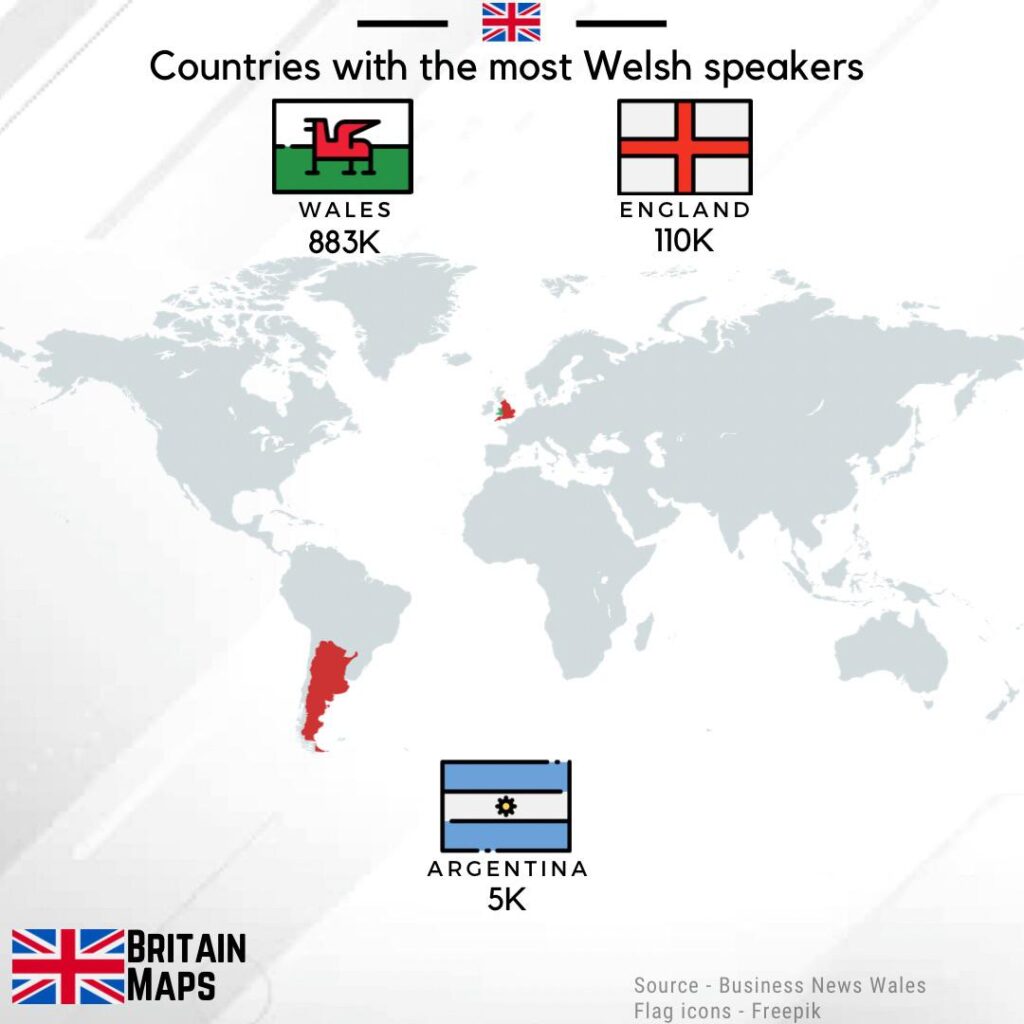
Did you know that the three countries with the most Cymraeg speakers are Cymru, England and Argentina?
This number is ever-changing, however, and has likely done so since this map was made as more and more people around the world are learning Cymraeg.
Also, a fun fact: Cymraeg is often used by the British military as code during times of war (especially in World War II, where it was used to shield conversations from Nazi espionage). In the Falklands War, this tradition was dropped because of the thousands of people native to Y Wladfa in Argentina.
#15. Busting the myth of principality vs being a country.

The biggest myth I read on here, almost daily, is that we are still a principality and not a country.
We haven’t been a principality since the 16th century (specifically 1542 with the second Laws in Wales Act) – and there are arguments we were never one to begin with. This myth is often spread by the same disingenuous few people who come to the comment section to cause trouble.
Cymru is a country. Stop spreading the myth.
#16. Map titled, ‘Come to Beautiful Wales,’ 1953.
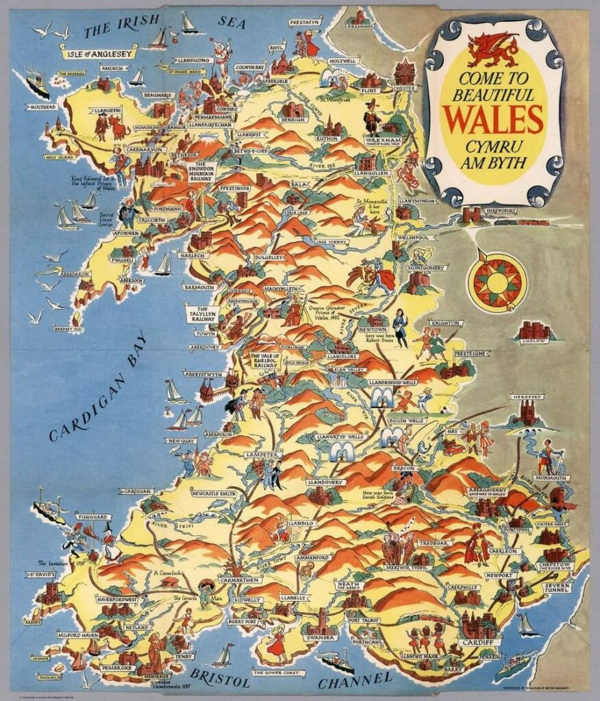
Lots of castles shown; as well as plenty of our best scenery (and the birth locations of historic Welsh figures).
It also has a lot more Welsh railway lines than we currently have. Cheers for that, Beeching 😒
#17. Native names of the six Celtic countries.
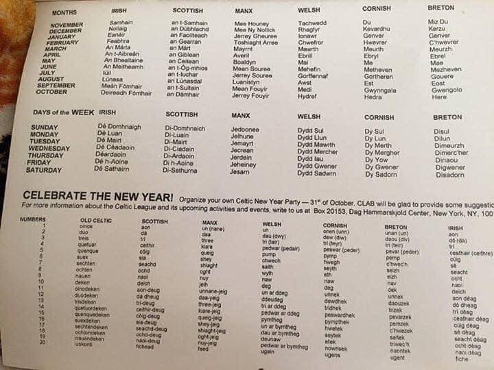
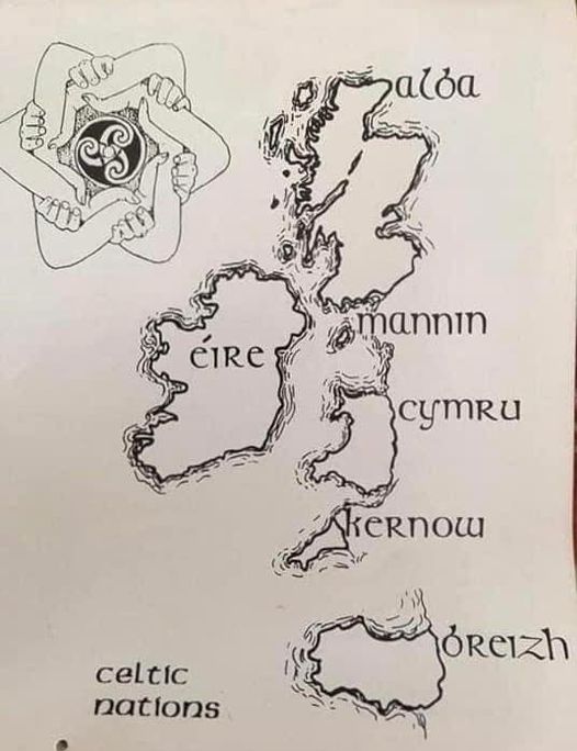
Here’s an interesting post I saw on Irish History 1916 through to 1923 which includes an old Celtic calendar that marks the days and months in the languages of the Six Celtic Nations: Breizh, Cymraeg, Irish, Kernowek, Manx and Scottish.
There is also a map included, which shows the native name for each of these Celtic nations. Pretty cool!
#18. What do we most associate King Offa with in Cymru? Offa’s Dyke.

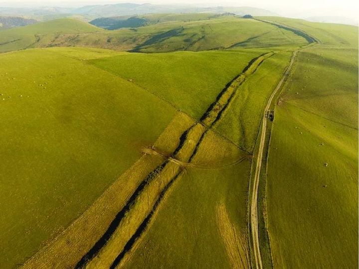
The Saxon King of Mercia, King Offa, died on this day (July 29) in 796 AD! What do we most associate King Offa with in Cymru? Offa’s Dyke.
Offa’s Dyke is the earthwork that (quite poorly in the present age, because Wrecsam is on the English side) roughly lines the border between present-day Cymru and England.
King Offa of the Kingdom of Mercia was the one to order the construction of the Offa’s Dyke. It was both a display of power and command of the people, and it also didn’t prevent future Mercian and Welsh struggles.
Many people today walk the entire length of Offa’s Dyke, which goes sea to sea (285 km in length) and connects Prestatyn (North Wales) with Cas-gwent (Chepstow). If you follow the path entirely, you will also cross the Welsh and English border 20 times!
#19. The Great Western Railway System from 1925.
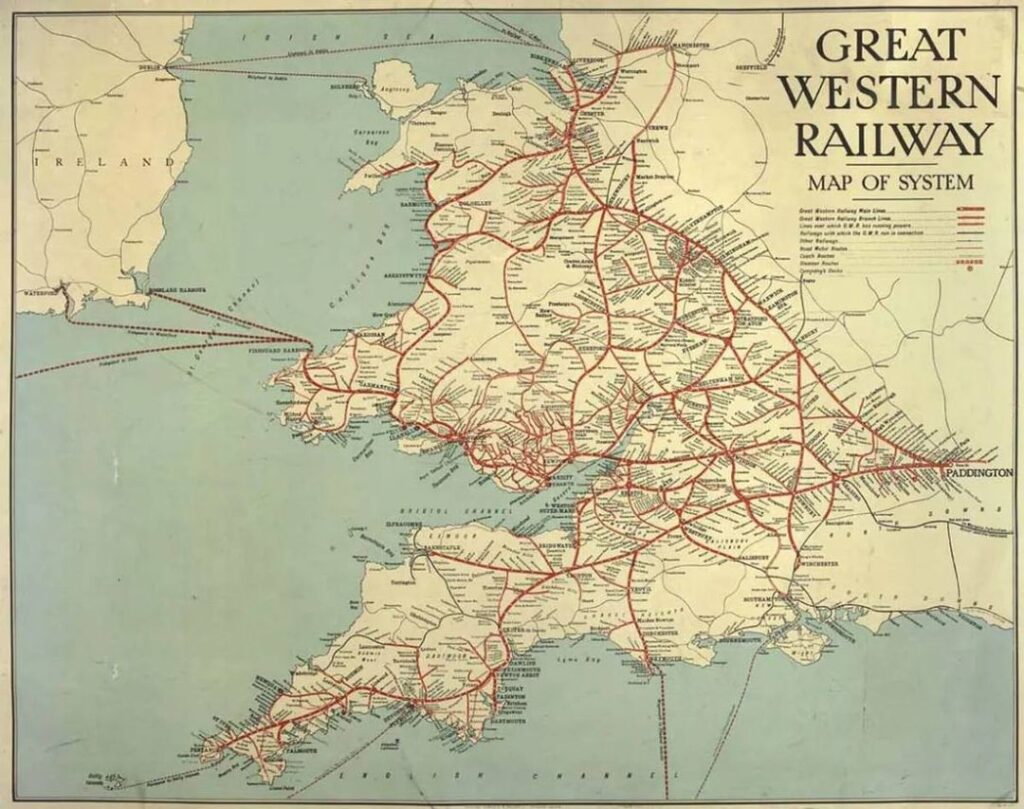
The less said about what would happen to our railway system in the coming decades, the better. 😒
#20. Map for the rail enthusiasts.
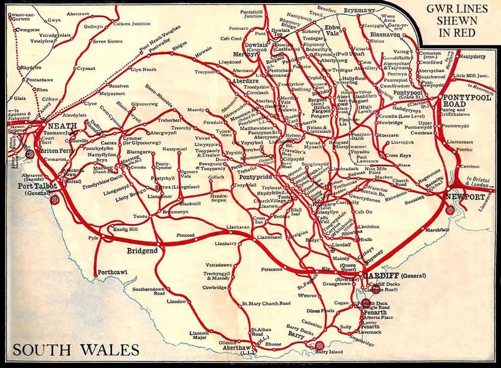
This was sent in by one of our readers, Ralph, and depicts the Great Western Railway lines in the south east of Cymru.
I am not certain on a year (though we have rail enthusiasts in the community who will be happy to correct) but I would assume this is from circa 1950.
I have said it many times and will almost certainly continue to do so: damn Beeching.
#21. Death of Gruffydd ap Llywelyn (1010 – 1063).
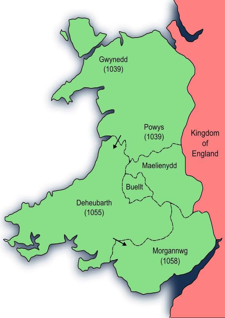
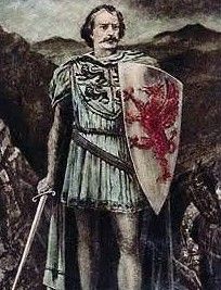
One of the great Welsh Kings, and the only one to truly be King of all of Cymru, was murdered on this day on August 5, 1063.
Gruffydd ap Llywelyn (1010-1063) successfully managed to unite Cymru under one rule in 1055 and it lasted until his death eight years later. The country was united and, mostly, internally peaceful.
His death was brought upon by the forces of his arch-rival, Harold Godwinson, in Eryri – just three years before the Norman Conquest of England which would bring about the death of Harold at the Battle of Hastings.
The map shows in which year each Welsh Kingdom came under his rulership.
#22. Famous men and women who came from Cymru.
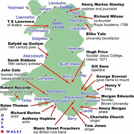
I have got The Alarm for Rhyl!
Who’s the most recognisable figure from your Welsh town?
#23. Welsh coal mining and South Wales coalfield.
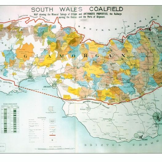
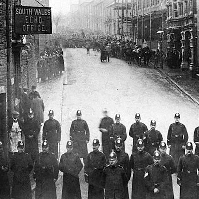
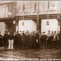
Cymru has a rich history closely tied to the mining industry, particularly coal mining. The story of Welsh coal mining is one of labour, struggle, and profound societal changes. It played a pivotal role in shaping both the nation’s economy and the lives of its people.
The history of coal mining in Cymru can be traced back to the medieval period when coal was extracted for local use. However, it wasn’t until the 18th century that the industry gained significant momentum. The demand for coal, a vital source of fuel for industry and transportation, led to the expansion of mining operations.
One of the most significant developments in Welsh coal mining was the emergence of the South Wales Coalfield. This vast coalfield, stretching from the western coal mines in Pembrokeshire to the eastern coalfields near Newport, became the heart of Cymru’s coal industry. The South Wales Coalfield was a prolific producer of coal, providing fuel for the industrial revolution and powering the British Empire.
The coal mining industry in Cymru was marked by difficult and often dangerous working conditions. Miners toiled underground in cramped, poorly-ventilated tunnels. The risks of accidents and health issues were ever-present. These challenging conditions led to labour disputes and strikes as miners fought for better wages, safer workplaces, and improved living standards.
One of the most significant labour strikes in Welsh history was the Tonypandy Riots in 1910-1911. This strike, which centered in the Rhondda Valley, pitted striking miners against the authorities and mine owners. It resulted in violence and unrest, leaving a lasting mark on the collective memory of the Welsh people.
The coal mining industry wasn’t just a source of employment; it was the lifeblood of many Welsh communities. Entire towns and villages were built around the mines, with mining families forming tight-knit communities. The industry influenced the culture, traditions, and way of life in these areas.
As the coal mining industry declined in the latter half of the 20th century due to economic changes and a shift towards alternative energy sources, Welsh mining communities faced significant challenges. The closure of mines had profound social and economic impacts, including high unemployment rates and the need for reinvention and adaptation.
Today, the legacy of Welsh coal mining is preserved in museums and heritage sites across Cymru. The Big Pit National Coal Museum in Blaenavon, for instance, offers a glimpse into the lives of coal miners and the industry’s history. It serves as a reminder of the sacrifices and contributions of those who worked in the mines.
Welsh coal mining’s history is a testament to the resilience of the Welsh people and their ability to adapt in the face of adversity. It’s a story of hard work, determination, and the enduring spirit of communities that were deeply connected to the coal industry. The legacy of coal mining continues to shape Welsh identity and remind us of the importance of preserving industrial heritage.
Share us your favourite Welsh maps on niklas@welshhistories.co.uk
This week’s popular products
More from Welsh Histories
Welsh Histories is a Welsh history celebrating platform which looks to promote all aspects of Welsh history. Though we focus predominantly on native Welsh history, we do also share the non-native aspects from time to time. You can follow us on Facebook; Instagram or Twitter for more. A reader? We also have our very own Welsh Histories Shop where we sell our Welsh Histories Magazine. Diolch yn fawr iawn and keep enjoying Welsh Histories
Niklas is the founder, owner, manager, editor, writer, video creator, voice over artist, and so forth, of Welsh Histories. He is passionate about the preservation of Welsh culture; the rejuvenation of the Welsh language and the promotion of Welsh history. Niklas currently resides in Pune, Maharashtra, with his beloved wife.
Comments
2 responses to “Welsh Maps That Will Make You Feel Smart About Welsh History”
[…] must truly be a Welsh maps enthusiast if you have come to read part-2, after the part-1 series. We’ve gathered some more of Welsh maps shown on our Facebook page. How many of these can […]
[…] Welsh Maps That Will Make You Feel Smart About Welsh History […]